
The toll released Saturday, 10 October, after Isaias passed raised the number of fatalities to four and put the number of customers without power in Florida, Alabama, Georgia and Mississippi at about 670 thousand. The system had already lost its tropical characteristics, but the risk of flash flooding inland continued.
The impact figures correspond to the report published by CNA on Saturday, which cites authorities and electric-service monitoring services. They are a snapshot of an unfolding emergency, not a definitive total of damage or casualties.
What changed after landfall
Isaias hit the Florida coast as a Category 2 hurricane. In its latest advisory, issued at 04:00 U.S. central time on day 10, the National Hurricane Center classified it as a post-tropical cyclone over Alabama and reported maximum sustained winds of 55 km/h.
The NHC explained that deep convection had shifted north of the center and that the system had developed a frontal structure. For that reason, it transferred subsequent monitoring to the Weather Prediction Center. The change in name describes its meteorological structure; it does not mean that all the rain or its effects have disappeared.
With that advisory, tropical storm and storm surge warnings associated with the system were canceled. This does not automatically cancel local flood advisories, road closures or emergency instructions. Each product has a different scope and should be read with its date and area in mind.
Power outages and roads require separate attention
The CNA report counted approximately 420 thousand customers without power in Florida, 190 thousand in Alabama, 43 thousand in Georgia and 17 thousand in Mississippi. The total describes affected electrical connections, not an exact count of people: one home or business may account for several customers.
Authorities cited fallen trees and power lines among the risks to travel. Two of the reported deaths were attributed to trees that fell on homes. Damage assessments and power restoration continued throughout the day.
How to follow an emergency that has entered a new phase
For people with family or travel plans in the southeastern United States, it is helpful to check three things separately: the rainfall forecast, local emergency advisories, and the specific status of the route, airport or power supply. A general bulletin does not certify that an individual road is open.
It is also not safe to interpret the drop in winds as authorization to drive through standing water or approach a downed power line. Follow instructions from the local weather service and authorities; flood and electrical hazards can persist after the center passes.
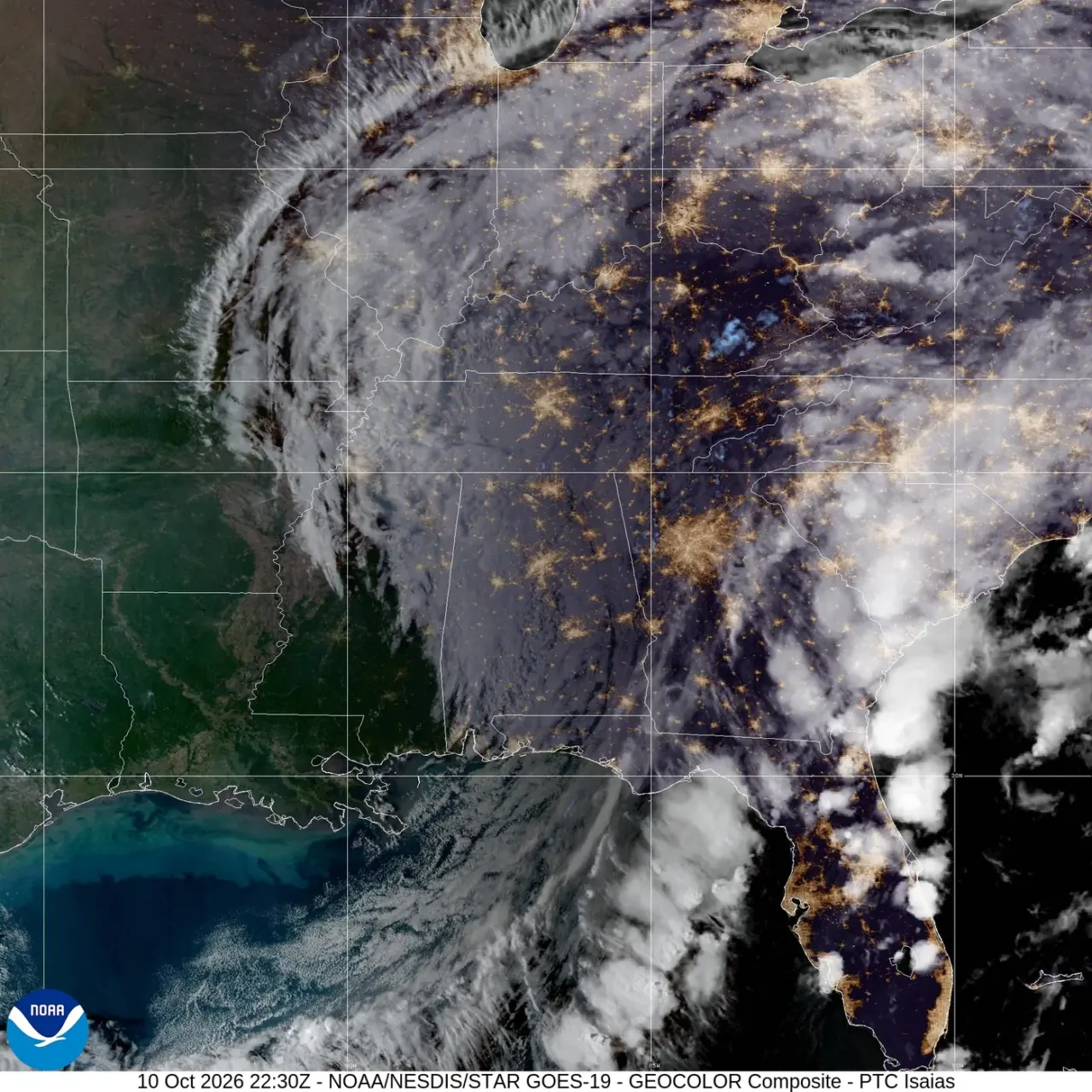
The satellite image shows Isaias on 10 October 2026 at 22:30 UTC, equivalent to 16:30 in Mexico City time. It does not show the namesake hurricane of 2020 and is not, by itself, a map of safe areas.