
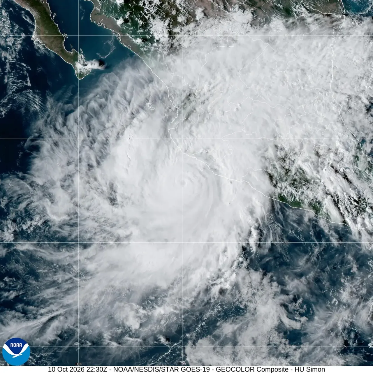
Simón is a Category 4 hurricane off Mexico’s Pacific coast. Advisory 14 from the U.S. National Hurricane Center, issued at 15:00 Mexico City time on Saturday, October 10, reported maximum sustained winds of 240 km/h and placed the center about 165 kilometers south-southwest of Manzanillo.
The system was moving north at seven kilometers per hour, with a central pressure of 932 millibars. The NHC forecast placed its center near or over Mexico’s central-western coast on Sunday. That projected track does not amount to advance confirmation of a specific municipality or exact time of impact.
Where advisories remain in effect
The hurricane warning covers the area from Punta San Telmo to El Roblito, as well as the Islas Marías. East of Punta San Telmo, a tropical storm watch remains in effect as far as Lázaro Cárdenas. These are different types of advisories: the first indicates expected conditions, and the second indicates possible conditions within the area specified.
According to the bulletin, tropical storm conditions may begin reaching part of the warning area as early as Saturday afternoon, before the center arrives. Hurricane conditions are possible in the southern part of the area under warning starting early Sunday. Evacuation instructions and shelter openings are up to Civil Protection and local authorities.
Rain can cause damage far from the eye
The NHC forecasts 10 to 20 inches of rain, approximately 254 to 508 millimeters, in parts of Michoacán, Colima and Jalisco through Sunday, with isolated maximums of 30 inches, about 762 millimeters. These are accumulations for the forecast period, not amounts that have already fallen in every locality.
The combination of heavy rain and mountainous terrain poses a risk of flash flooding and landslides. Storm surge, surf and currents can also affect the coast. Category 4 describes wind intensity and does not sum up all these hazards: being far from the forecast track’s centerline does not eliminate exposure to rain or rising water.
Why the forecast could still change
The reconnaissance aircraft identified a concentric eyewall structure. The NHC’s technical discussion also notes uncertainty due to the system’s proximity to land: greater interaction with the coast could alter its intensity, while a track over the ocean would allow for a different evolution.
This update retains an explicit cutoff: 15:00 Mexico City time on October 10. The NHC scheduled the next intermediate advisory for 18:00 and the full advisory for 21:00; check the latest document before making decisions or sharing a map.
Avoid crossing currents or flooded roads, or going near the beach to watch the surf. If your locality orders an evacuation, follow the designated routes and go to the shelters that have been opened. In an emergency, call 911. The satellite image accompanying the article has its own observation time and does not replace official advisories.